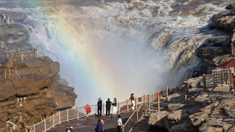
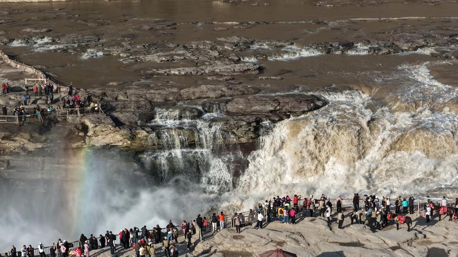
ZHENGZHOU, Nov. 2 (Xinhua) -- The Hukou Waterfall on the Yellow River, once depicted on China's fourth-series 50-yuan banknotes as a torrent of muddy, turbulent water, now presents a markedly different scene, with its cascading waters running clear.
Photographer Lyu Guiming, known for documenting the waterfall in Jixian County, Shanxi Province, since 1999, has witnessed the change.
"Over the past decade, clear cascades at the waterfall have been my main photographic subject," Lyu said. "The contrast with the old scenes is striking."
The changing waterscape reflects decades of efforts to protect and manage the Yellow River, China's second-longest river, which flows 5,464 km from its source in the highlands of Qinghai Province through nine provinces and autonomous regions, crossing deserts and loess lands before emptying into the Bohai Sea in Shandong Province, east China.
In 1946, under the leadership of the Communist Party of China, an agency for people's Yellow River management was established on the river's banks in Heze, Shandong Province.
Because Henan Province was frequently affected by flooding on the river, the Yellow River Conservancy Commission (YRCC) later moved its headquarters to Zhengzhou in December 1953.
Thanks to 80 years of conservation efforts, the river, once prone to devastating floods, heavy sedimentation and shifting channels, now has cleaner waters and more sustainable water use.
Historical records show that before the founding of the People's Republic of China in 1949, the river's lower reaches experienced more than 1,500 dyke breaches and overflows and changed course 26 times. Sediment was a persistent challenge, giving rise to the old saying that half of a bowl of Yellow River water is sand.
Wei Xiangyang, the commission's chief engineer, outlined progress in flood control, a central part of river management.
Dykes built to withstand major floods now stretch 1,371 km in total along the lower reaches. Forty flood-control reservoirs on the river and its tributaries have a combined flood-control capacity of 19 billion cubic meters.
Over the past eight decades, these infrastructure projects have helped avoid an estimated 10.09 trillion yuan (around 1.5 trillion U.S. dollars) in economic losses from floods, Wei said.
Efforts to curb soil erosion have also produced substantial results. Zhu Xiaoyong, director of the commission's soil and water conservation bureau, presented data showing that 290,500 square km of land affected by soil erosion across the river basin have been rehabilitated. Soil and water conservation measures have kept about 24.7 billion tonnes of sediment from entering the river.
The Yellow River spans multiple regions and forms an integrated ecosystem that requires coordinated cross-regional management.
"After years of research, we have developed a reservoir operation approach that stores clean water while discharging sediment," said Zhang Jinliang, chief scientist of Yellow River Engineering Consulting Co., Ltd. "Precision water-sediment regulation marks a shift from passive response to proactive action in managing the river."
Water allocation has also achieved better coordination. Since a unified water-management system covering all provincial-level regions along the river was introduced in 1999, the Yellow River has flowed uninterrupted for 27 consecutive years.
Over the years, more efficient water use has helped expand irrigated farmland in the river basin to 132 million mu (8.8 million hectares). The basin and downstream irrigation areas produce roughly 89.5 billion kilograms of grain annually, or 13.3 percent of China's national grain output.
YRCC figures also show that water quality in the Yellow River Basin has markedly improved. The proportion of monitoring sections graded Class I to III, indicating good water quality, rose from 59.1 percent in 2016 to 93.2 percent in 2025.
The changes are also visible in communities along the river. Lyu's photographs documenting the Hukou Waterfall's shifting waterscape have helped boost local tourism. His widely shared photos have helped turn tourism into a pillar industry in a county that was once impoverished.
"The Yellow River ecosystem forms an integrated whole," he said. "From headwater conservation in the upper reaches and soil and water conservation in the middle reaches to wetland restoration in the lower reaches, green has become a defining feature of high-quality development in the Yellow River Basin." ■