URUMQI, Oct. 10 (Xinhua) -- Scientists with China's Third Xinjiang Scientific Expedition announced on Saturday that they had found more than 24,000 glaciers in the region and warned of accelerating melt there.
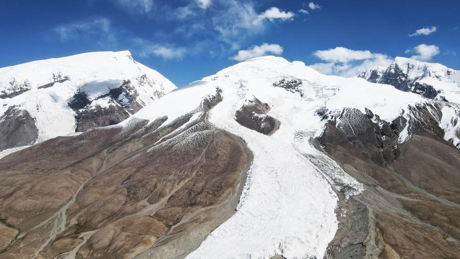
Xinjiang Uygur Autonomous Region in northwest China ranks first in glacier reserves in the country, followed by Xizang Autonomous Region in southwest China. At a press conference in Urumqi, Xinjiang's capital, the expedition team released the latest data, saying Xinjiang is home to 24,202 glaciers, covering 23,629 square km.
The glacier study is part of a five-year expedition, which was launched in 2021 by the Ministry of Science and Technology. The previous two were conducted in the 1950s and 1980s.
The expedition carried out studies on Xinjiang's ecology, land and agriculture, biodiversity and biological resources, mineral, energy and water resources. Forty-six national research institutions joined the work, with over 6,000 person-times of expedition members.
While the two earlier surveys centered on basic, census-based static resource inventory, this mission yields fresh first-hand data on Xinjiang's climate, ecology and resources.
From the 1990s to 2020, Xinjiang has lost 2,167 square km of glacier area, and most parts of this glacier-rich region are experiencing rapid melting, according to the expedition team.
Global warming is the main cause, said expedition member Li Zhongqin, a glacier researcher at the Northwest Institute of Eco-Environment and Resources under the Chinese Academy of Sciences (CAS).
The region has been warming faster than the global and national averages. The expedition team noted that over the past three decades, Xinjiang's temperature has been rising at a rate of 0.34 degrees Celsius per decade, roughly 1.7 times the global average and 1.13 times the national average.
The surface of lakes and wetlands in Xinjiang has grown by roughly one-third, also partly due to glacier melt, Li said.
Glaciers are vital to Xinjiang as the sources of many rivers in this inland region. Faster melting can increase river runoff, but it can also cause ice avalanches and raise the risk of floods and mudslides, Li told Xinhua, adding that glacier collapses are likely to become frequent in this region.
Strengthening of monitoring efforts is necessary to respond to these risks. Li and his colleagues have used remote sensing satellites and drones to track glacier movement and temperature changes.
Another highlight of the expedition was joint cross-border glacier research, including the identification of glaciers in Tajikistan, which neighbors southwestern Xinjiang, and the publication of an atlas of that country's glaciers.
Scientific cooperation between the two countries stems from the common challenge of glacier melt, said Li Zhi, a researcher at the Xinjiang Institute of Ecology and Geography under the CAS. She and her colleagues have launched a UNESCO-recognized project that focuses on assessing glacial changes in Tajikistan, predicting future glacier trends and studying the risks of glacier-related disasters.
Tajikistan has many glaciers, and melt could lead to disastrous events, such as glacial lake outburst floods, which may endanger local residents, she added.
Besides glacier melt, the expedition also focused on other common regional challenges, such as water scarcity and desertification, and carried out joint scientific research with Central Asian countries. ■