
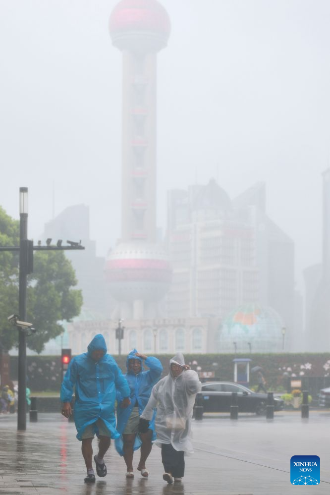
People walk amid rain at Huangpu District of Shanghai, east China, on Aug. 9, 2026. China's eastern metropolis Shanghai issued its highest rainstorm alert Sunday over rising risks of urban waterlogging brought by Typhoon Dolphin, the 13th typhoon of the year that has a great impact on the country's coastal regions. China's national observatory on Sunday activated a red alert -- the highest level in the country's typhoon warning system -- as Typhoon Dolphin approaches. Typhoon Dolphin is forecast to make landfall along the country's east coast from Sanmen in Zhejiang Province to Fuding in Fujian Province around Sunday evening to the early hours of Monday, according to the National Meteorological Center (NMC). (Xinhua/Wang Xiang)
BEIJING, Aug. 9 (Xinhua) -- China's national observatory on Sunday activated a red alert -- the highest level in the country's typhoon warning system -- as Typhoon Dolphin approaches.
Typhoon Dolphin is forecast to make landfall along the country's east coast from Sanmen in Zhejiang Province to Fuding in Fujian Province around Sunday evening to the early hours of Monday, according to the National Meteorological Center (NMC).
Wang Haiping, NMC chief forecaster, said a high alert was required due to the typhoon's heavy rainfall intensity, extensive impact range and prolonged duration.
From Sunday to Wednesday, regions that include northern Fujian, Zhejiang, Shanghai, northern Jiangxi, Jiangsu, Anhui, eastern Hubei, central and eastern Henan, and southern Shandong, will be hit by heavy downpours, with some areas in central-eastern Zhejiang and southern Anhui facing severe torrential rain.
Addressing key areas of prevention, Wang said the coastal areas of East China and the East China Sea need to focus on guarding against gale-force winds. From Sunday to Tuesday, most parts of the East China Sea, Hangzhou Bay, the coastal areas of Zhejiang, and the Yangtze River Estuary, are expected to experience winds of Force 9 to 12, with gusts reaching Force 11 to 14, while gusts near the typhoon center could reach Force 15 to 16.
Relevant provinces also need to guard against secondary disasters triggered by persistent heavy rainfall. The risks of mountain torrents, geological disasters, and flash floods in small and medium-sized rivers are relatively high in Zhejiang, Anhui, Henan, and Hebei, while some cities face high risks of urban waterlogging.
NMC forecasts Typhoon Dolphin to move northwestward and gradually weaken after landfall. After Wednesday, the weakened remnant vortex will turn northward.
"A typhoon landfall does not mean its impact is over. After Dolphin makes landfall, it will push further inland," Wang said.
From Thursday to Sunday, the Beijing-Tianjin-Hebei region, northern Shandong and Liaoning are likely to see heavy rainfall, with some areas expected to experience severe torrential rain.
In response to the typhoon, China's meteorological authority on Sunday upgraded its emergency response for severe meteorological disasters from Level III to Level II. ■
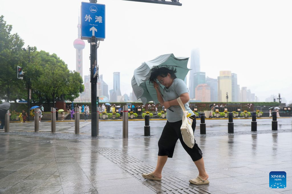
A woman with an umbrella walks amid rain at Huangpu District of Shanghai, east China, on Aug. 9, 2026. China's eastern metropolis Shanghai issued its highest rainstorm alert Sunday over rising risks of urban waterlogging brought by Typhoon Dolphin, the 13th typhoon of the year that has a great impact on the country's coastal regions.
China's national observatory on Sunday activated a red alert -- the highest level in the country's typhoon warning system -- as Typhoon Dolphin approaches.
Typhoon Dolphin is forecast to make landfall along the country's east coast from Sanmen in Zhejiang Province to Fuding in Fujian Province around Sunday evening to the early hours of Monday, according to the National Meteorological Center (NMC). (Xinhua/Wang Xiang)
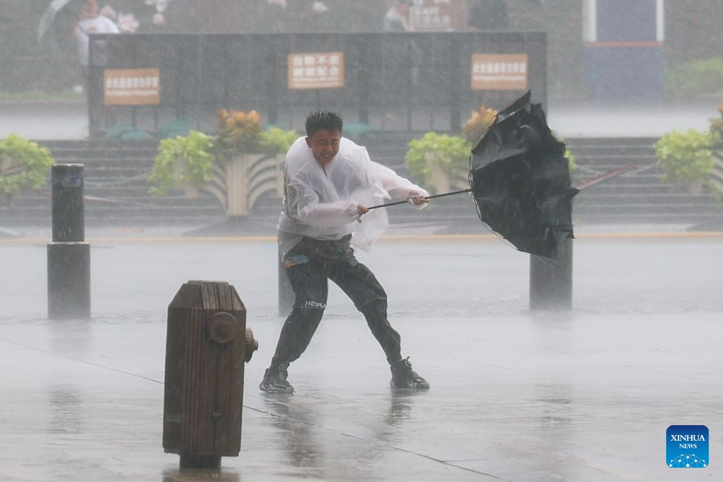
A man holds tightly onto an umbrella that is blown open by the wind amid rain at Huangpu District of Shanghai, east China, on Aug. 9, 2026. China's eastern metropolis Shanghai issued its highest rainstorm alert Sunday over rising risks of urban waterlogging brought by Typhoon Dolphin, the 13th typhoon of the year that has a great impact on the country's coastal regions.
China's national observatory on Sunday activated a red alert -- the highest level in the country's typhoon warning system -- as Typhoon Dolphin approaches.
Typhoon Dolphin is forecast to make landfall along the country's east coast from Sanmen in Zhejiang Province to Fuding in Fujian Province around Sunday evening to the early hours of Monday, according to the National Meteorological Center (NMC). (Xinhua/Wang Xiang)

A father and his child walk amid rain at Huangpu District of Shanghai, east China, on Aug. 9, 2026. China's eastern metropolis Shanghai issued its highest rainstorm alert Sunday over rising risks of urban waterlogging brought by Typhoon Dolphin, the 13th typhoon of the year that has a great impact on the country's coastal regions.
China's national observatory on Sunday activated a red alert -- the highest level in the country's typhoon warning system -- as Typhoon Dolphin approaches.
Typhoon Dolphin is forecast to make landfall along the country's east coast from Sanmen in Zhejiang Province to Fuding in Fujian Province around Sunday evening to the early hours of Monday, according to the National Meteorological Center (NMC). (Xinhua/Wang Xiang)