
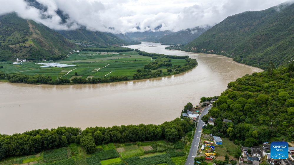
An aerial drone photo taken on July 2, 2026 shows a view along the Yunnan-Xizang Highway in Yulong Naxi Autonomous County of Lijiang, southwest China's Yunnan Province. Fifty years ago on this day, the Yunnan-Xizang Highway, a vital trunk road in China's southwestern border regions, was fully completed and opened to traffic.
Stretching 715 kilometers from Xiaguan County in Yunnan Province to Mangkam County in Xizang Autonomous Region, the route crosses the Jinsha and Lancang rivers, traverses the rugged and geologically complex Hengduan Mountains, and climbs over snow-capped passes. Connecting to the southern section of the Sichuan-Xizang Highway to Lhasa, it has forged a crucial land artery linking Yunnan and Xizang, ending the extreme geographical isolation of China's frontier southwest.
Half a century on, the once primitive lifeline built by manual labor has evolved into a modern alpine highway. More than just a traffic route, the upgraded Yunnan-Xizang Highway weaves together world-famous landscapes and millennia-old ethnic culture, fueling cultural tourism along the route. It has grown into a world-class tourism corridor that powers coordinated regional development and common prosperity for people of various ethnic groups. (Xinhua/Hu Chao)
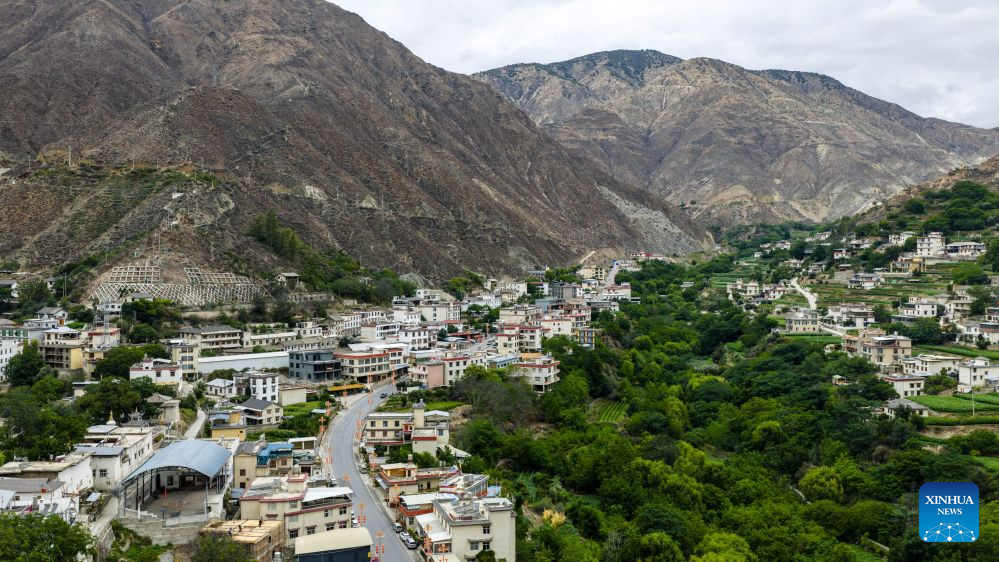
An aerial drone photo taken on July 1, 2026 shows a section of the Yunnan-Xizang Highway in Deqin County of Deqen Tibetan Autonomous Prefecture, southwest China's Yunnan Province. Fifty years ago on this day, the Yunnan-Xizang Highway, a vital trunk road in China's southwestern border regions, was fully completed and opened to traffic.
Stretching 715 kilometers from Xiaguan County in Yunnan Province to Mangkam County in Xizang Autonomous Region, the route crosses the Jinsha and Lancang rivers, traverses the rugged and geologically complex Hengduan Mountains, and climbs over snow-capped passes. Connecting to the southern section of the Sichuan-Xizang Highway to Lhasa, it has forged a crucial land artery linking Yunnan and Xizang, ending the extreme geographical isolation of China's frontier southwest.
Half a century on, the once primitive lifeline built by manual labor has evolved into a modern alpine highway. More than just a traffic route, the upgraded Yunnan-Xizang Highway weaves together world-famous landscapes and millennia-old ethnic culture, fueling cultural tourism along the route. It has grown into a world-class tourism corridor that powers coordinated regional development and common prosperity for people of various ethnic groups. (Xinhua/Hu Chao)

An aerial drone photo taken on July 4, 2026 shows a view of the ancient town of Dali along the Yunnan-Xizang Highway in southwest China's Yunnan Province. Fifty years ago on this day, the Yunnan-Xizang Highway, a vital trunk road in China's southwestern border regions, was fully completed and opened to traffic.
Stretching 715 kilometers from Xiaguan County in Yunnan Province to Mangkam County in Xizang Autonomous Region, the route crosses the Jinsha and Lancang rivers, traverses the rugged and geologically complex Hengduan Mountains, and climbs over snow-capped passes. Connecting to the southern section of the Sichuan-Xizang Highway to Lhasa, it has forged a crucial land artery linking Yunnan and Xizang, ending the extreme geographical isolation of China's frontier southwest.
Half a century on, the once primitive lifeline built by manual labor has evolved into a modern alpine highway. More than just a traffic route, the upgraded Yunnan-Xizang Highway weaves together world-famous landscapes and millennia-old ethnic culture, fueling cultural tourism along the route. It has grown into a world-class tourism corridor that powers coordinated regional development and common prosperity for people of various ethnic groups. (Xinhua/Hu Chao)
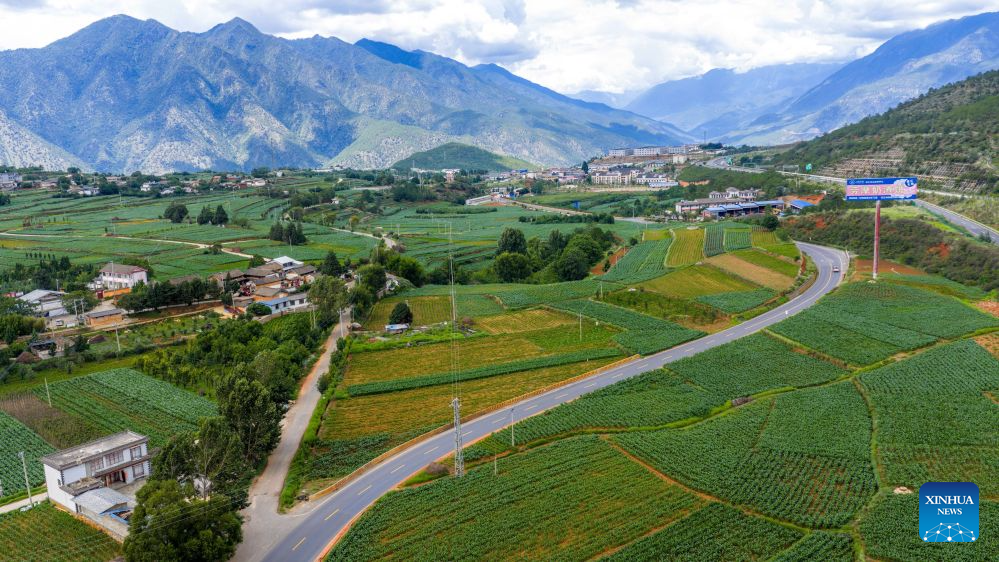
An aerial drone photo taken on July 4, 2026 shows a section of the old Yunnan-Xizang road (L) and a section of the Yunnan-Xizang Highway in Yulong Naxi Autonomous County of Lijiang, southwest China's Yunnan Province. Fifty years ago on this day, the Yunnan-Xizang Highway, a vital trunk road in China's southwestern border regions, was fully completed and opened to traffic.
Stretching 715 kilometers from Xiaguan County in Yunnan Province to Mangkam County in Xizang Autonomous Region, the route crosses the Jinsha and Lancang rivers, traverses the rugged and geologically complex Hengduan Mountains, and climbs over snow-capped passes. Connecting to the southern section of the Sichuan-Xizang Highway to Lhasa, it has forged a crucial land artery linking Yunnan and Xizang, ending the extreme geographical isolation of China's frontier southwest.
Half a century on, the once primitive lifeline built by manual labor has evolved into a modern alpine highway. More than just a traffic route, the upgraded Yunnan-Xizang Highway weaves together world-famous landscapes and millennia-old ethnic culture, fueling cultural tourism along the route. It has grown into a world-class tourism corridor that powers coordinated regional development and common prosperity for people of various ethnic groups. (Xinhua/Hu Chao)
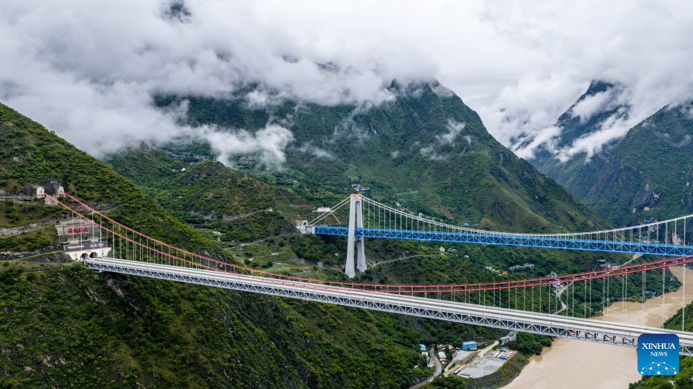
An aerial drone photo taken on July 2, 2026 shows bridges along the Lijiang-Shangri-la railway which connect Lijiang City and Deqen Tibetan Autonomous Prefecture, southwest China's Yunnan Province. Fifty years ago on this day, the Yunnan-Xizang Highway, a vital trunk road in China's southwestern border regions, was fully completed and opened to traffic.
Stretching 715 kilometers from Xiaguan County in Yunnan Province to Mangkam County in Xizang Autonomous Region, the route crosses the Jinsha and Lancang rivers, traverses the rugged and geologically complex Hengduan Mountains, and climbs over snow-capped passes. Connecting to the southern section of the Sichuan-Xizang Highway to Lhasa, it has forged a crucial land artery linking Yunnan and Xizang, ending the extreme geographical isolation of China's frontier southwest.
Half a century on, the once primitive lifeline built by manual labor has evolved into a modern alpine highway. More than just a traffic route, the upgraded Yunnan-Xizang Highway weaves together world-famous landscapes and millennia-old ethnic culture, fueling cultural tourism along the route. It has grown into a world-class tourism corridor that powers coordinated regional development and common prosperity for people of various ethnic groups. (Xinhua/Hu Chao)
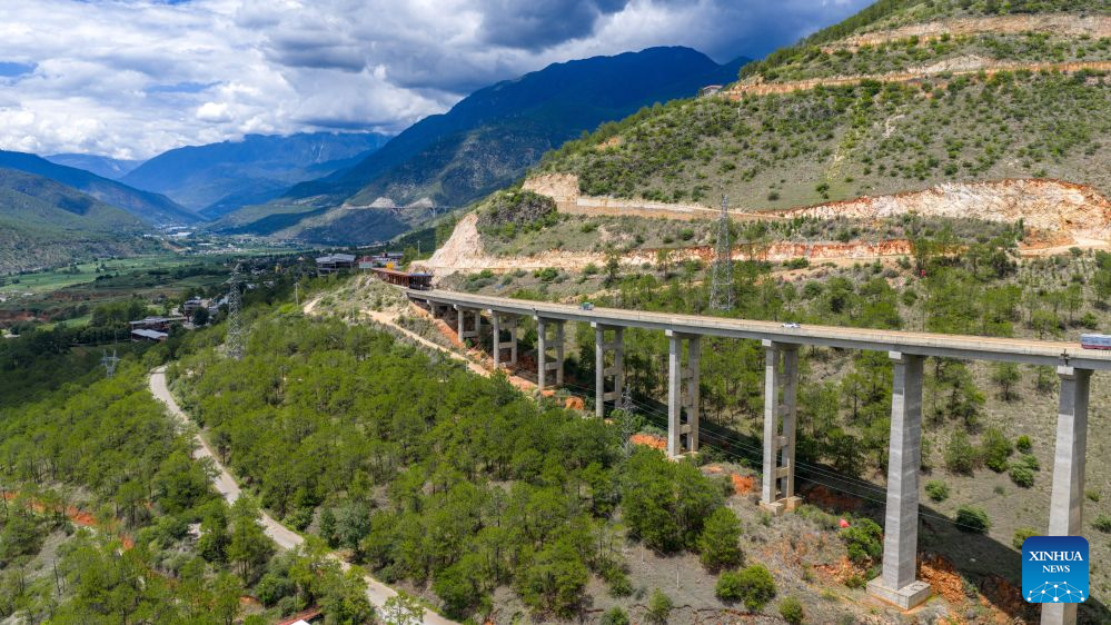
An aerial drone photo taken on July 4, 2026 shows a section of the old Yunnan-Xizang road (below) and a section of the Yunnan-Xizang Highway in Yulong Naxi Autonomous County of Lijiang, southwest China's Yunnan Province. Fifty years ago on this day, the Yunnan-Xizang Highway, a vital trunk road in China's southwestern border regions, was fully completed and opened to traffic.
Stretching 715 kilometers from Xiaguan County in Yunnan Province to Mangkam County in Xizang Autonomous Region, the route crosses the Jinsha and Lancang rivers, traverses the rugged and geologically complex Hengduan Mountains, and climbs over snow-capped passes. Connecting to the southern section of the Sichuan-Xizang Highway to Lhasa, it has forged a crucial land artery linking Yunnan and Xizang, ending the extreme geographical isolation of China's frontier southwest.
Half a century on, the once primitive lifeline built by manual labor has evolved into a modern alpine highway. More than just a traffic route, the upgraded Yunnan-Xizang Highway weaves together world-famous landscapes and millennia-old ethnic culture, fueling cultural tourism along the route. It has grown into a world-class tourism corridor that powers coordinated regional development and common prosperity for people of various ethnic groups. (Xinhua/Hu Chao)
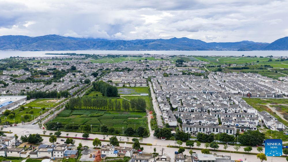
An aerial drone photo taken on July 4, 2026 shows a view of Xizhou Ancient Town along the Yunnan-Xizang Highway in Dali Bai Autonomous Prefecture, southwest China's Yunnan Province. Fifty years ago on this day, the Yunnan-Xizang Highway, a vital trunk road in China's southwestern border regions, was fully completed and opened to traffic.
Stretching 715 kilometers from Xiaguan County in Yunnan Province to Mangkam County in Xizang Autonomous Region, the route crosses the Jinsha and Lancang rivers, traverses the rugged and geologically complex Hengduan Mountains, and climbs over snow-capped passes. Connecting to the southern section of the Sichuan-Xizang Highway to Lhasa, it has forged a crucial land artery linking Yunnan and Xizang, ending the extreme geographical isolation of China's frontier southwest.
Half a century on, the once primitive lifeline built by manual labor has evolved into a modern alpine highway. More than just a traffic route, the upgraded Yunnan-Xizang Highway weaves together world-famous landscapes and millennia-old ethnic culture, fueling cultural tourism along the route. It has grown into a world-class tourism corridor that powers coordinated regional development and common prosperity for people of various ethnic groups. (Xinhua/Hu Chao)
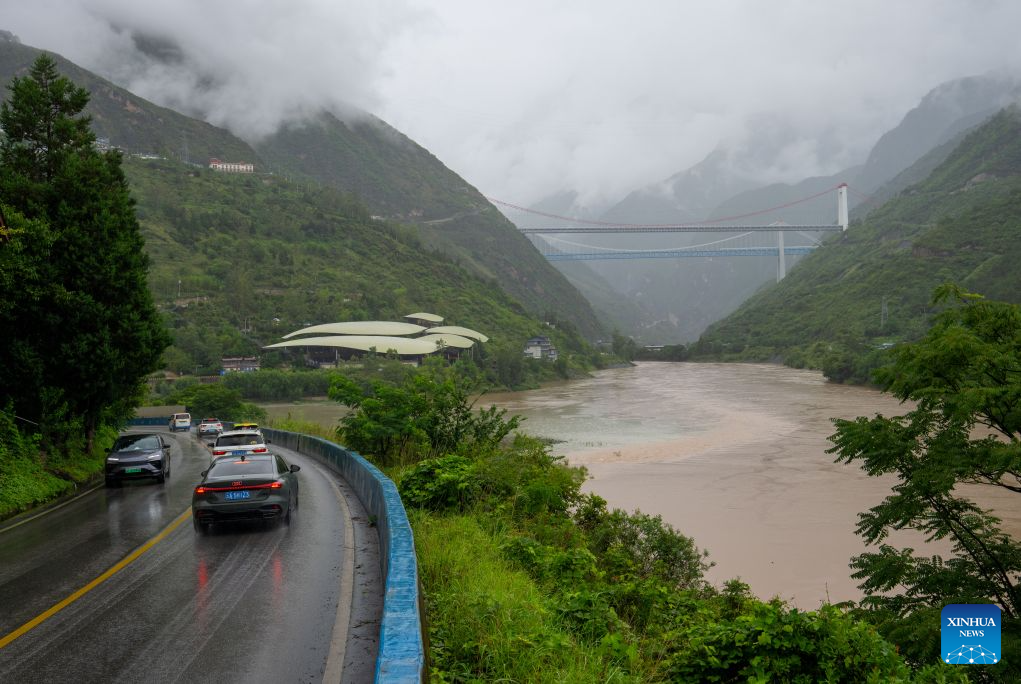
Vehicles travel along the Yunnan-Xizang Highway, with bridges along the Lijiang-Shangri-la railway visible in the distance, in southwest China's Yunnan Province, July 2, 2026. Fifty years ago on this day, the Yunnan-Xizang Highway, a vital trunk road in China's southwestern border regions, was fully completed and opened to traffic.
Stretching 715 kilometers from Xiaguan County in Yunnan Province to Mangkam County in Xizang Autonomous Region, the route crosses the Jinsha and Lancang rivers, traverses the rugged and geologically complex Hengduan Mountains, and climbs over snow-capped passes. Connecting to the southern section of the Sichuan-Xizang Highway to Lhasa, it has forged a crucial land artery linking Yunnan and Xizang, ending the extreme geographical isolation of China's frontier southwest.
Half a century on, the once primitive lifeline built by manual labor has evolved into a modern alpine highway. More than just a traffic route, the upgraded Yunnan-Xizang Highway weaves together world-famous landscapes and millennia-old ethnic culture, fueling cultural tourism along the route. It has grown into a world-class tourism corridor that powers coordinated regional development and common prosperity for people of various ethnic groups. (Xinhua/Jiang Wenyao)
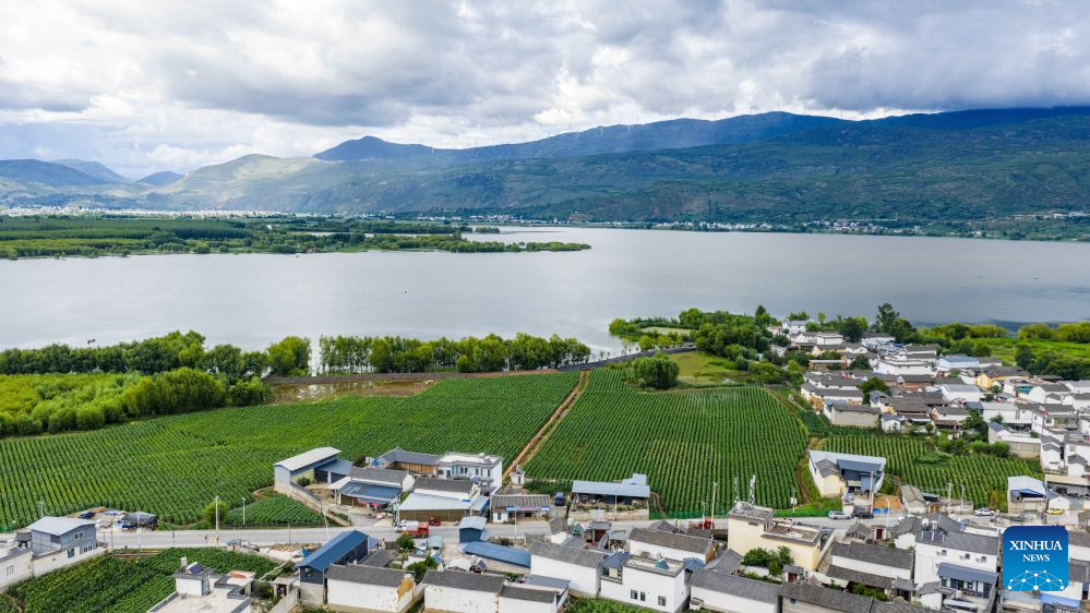
An aerial drone photo taken on July 4, 2026 shows the Yunnan-Xizang Highway passing through Jianchuan County in Dali Bai Autonomous Prefecture, southwest China's Yunnan Province. Fifty years ago on this day, the Yunnan-Xizang Highway, a vital trunk road in China's southwestern border regions, was fully completed and opened to traffic.
Stretching 715 kilometers from Xiaguan County in Yunnan Province to Mangkam County in Xizang Autonomous Region, the route crosses the Jinsha and Lancang rivers, traverses the rugged and geologically complex Hengduan Mountains, and climbs over snow-capped passes. Connecting to the southern section of the Sichuan-Xizang Highway to Lhasa, it has forged a crucial land artery linking Yunnan and Xizang, ending the extreme geographical isolation of China's frontier southwest.
Half a century on, the once primitive lifeline built by manual labor has evolved into a modern alpine highway. More than just a traffic route, the upgraded Yunnan-Xizang Highway weaves together world-famous landscapes and millennia-old ethnic culture, fueling cultural tourism along the route. It has grown into a world-class tourism corridor that powers coordinated regional development and common prosperity for people of various ethnic groups. (Xinhua/Hu Chao)
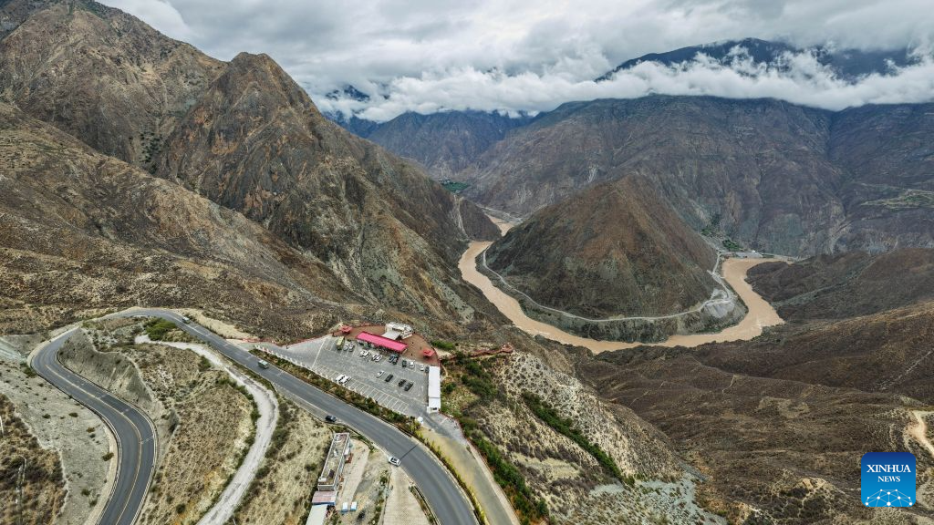
An aerial drone photo taken on July 1, 2026 shows a section of the Yunnan-Xizang Highway and a bend of the Jinsha River, the upper section of the Yangtze River, in Deqin County of Deqen Tibetan Autonomous Prefecture, southwest China's Yunnan Province. Fifty years ago on this day, the Yunnan-Xizang Highway, a vital trunk road in China's southwestern border regions, was fully completed and opened to traffic.
Stretching 715 kilometers from Xiaguan County in Yunnan Province to Mangkam County in Xizang Autonomous Region, the route crosses the Jinsha and Lancang rivers, traverses the rugged and geologically complex Hengduan Mountains, and climbs over snow-capped passes. Connecting to the southern section of the Sichuan-Xizang Highway to Lhasa, it has forged a crucial land artery linking Yunnan and Xizang, ending the extreme geographical isolation of China's frontier southwest.
Half a century on, the once primitive lifeline built by manual labor has evolved into a modern alpine highway. More than just a traffic route, the upgraded Yunnan-Xizang Highway weaves together world-famous landscapes and millennia-old ethnic culture, fueling cultural tourism along the route. It has grown into a world-class tourism corridor that powers coordinated regional development and common prosperity for people of various ethnic groups. (Xinhua/Hu Chao)
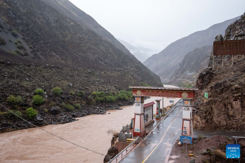
An aerial drone photo taken on July 1, 2026 shows the border between Deqin County of Deqen Tibetan Autonomous Prefecture, southwest China's Yunnan Province, and Mangkam County of Qamdo, southwest China's Xizang Autonomous Region, along the Yunnan-Xizang Highway. Fifty years ago on this day, the Yunnan-Xizang Highway, a vital trunk road in China's southwestern border regions, was fully completed and opened to traffic.
Stretching 715 kilometers from Xiaguan County in Yunnan Province to Mangkam County in Xizang Autonomous Region, the route crosses the Jinsha and Lancang rivers, traverses the rugged and geologically complex Hengduan Mountains, and climbs over snow-capped passes. Connecting to the southern section of the Sichuan-Xizang Highway to Lhasa, it has forged a crucial land artery linking Yunnan and Xizang, ending the extreme geographical isolation of China's frontier southwest.
Half a century on, the once primitive lifeline built by manual labor has evolved into a modern alpine highway. More than just a traffic route, the upgraded Yunnan-Xizang Highway weaves together world-famous landscapes and millennia-old ethnic culture, fueling cultural tourism along the route. It has grown into a world-class tourism corridor that powers coordinated regional development and common prosperity for people of various ethnic groups. (Xinhua/Jiang Wenyao)
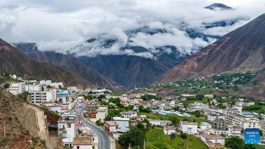
An aerial drone photo taken on July 1, 2026 shows a view along the Yunnan-Xizang Highway in Mangkam County, Qamdo, southwest China's Xizang Autonomous Region. Fifty years ago on this day, the Yunnan-Xizang Highway, a vital trunk road in China's southwestern border regions, was fully completed and opened to traffic.
Stretching 715 kilometers from Xiaguan County in Yunnan Province to Mangkam County in Xizang Autonomous Region, the route crosses the Jinsha and Lancang rivers, traverses the rugged and geologically complex Hengduan Mountains, and climbs over snow-capped passes. Connecting to the southern section of the Sichuan-Xizang Highway to Lhasa, it has forged a crucial land artery linking Yunnan and Xizang, ending the extreme geographical isolation of China's frontier southwest.
Half a century on, the once primitive lifeline built by manual labor has evolved into a modern alpine highway. More than just a traffic route, the upgraded Yunnan-Xizang Highway weaves together world-famous landscapes and millennia-old ethnic culture, fueling cultural tourism along the route. It has grown into a world-class tourism corridor that powers coordinated regional development and common prosperity for people of various ethnic groups. (Xinhua/Hu Chao)
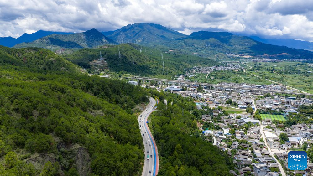
An aerial drone photo taken on July 4, 2026 shows a view of the section between Baihanchang to Lijiang along the Yunnan-Xizang Highway in southwest China's Yunnan Province. Fifty years ago on this day, the Yunnan-Xizang Highway, a vital trunk road in China's southwestern border regions, was fully completed and opened to traffic.
Stretching 715 kilometers from Xiaguan County in Yunnan Province to Mangkam County in Xizang Autonomous Region, the route crosses the Jinsha and Lancang rivers, traverses the rugged and geologically complex Hengduan Mountains, and climbs over snow-capped passes. Connecting to the southern section of the Sichuan-Xizang Highway to Lhasa, it has forged a crucial land artery linking Yunnan and Xizang, ending the extreme geographical isolation of China's frontier southwest.
Half a century on, the once primitive lifeline built by manual labor has evolved into a modern alpine highway. More than just a traffic route, the upgraded Yunnan-Xizang Highway weaves together world-famous landscapes and millennia-old ethnic culture, fueling cultural tourism along the route. It has grown into a world-class tourism corridor that powers coordinated regional development and common prosperity for people of various ethnic groups. (Xinhua/Hu Chao)
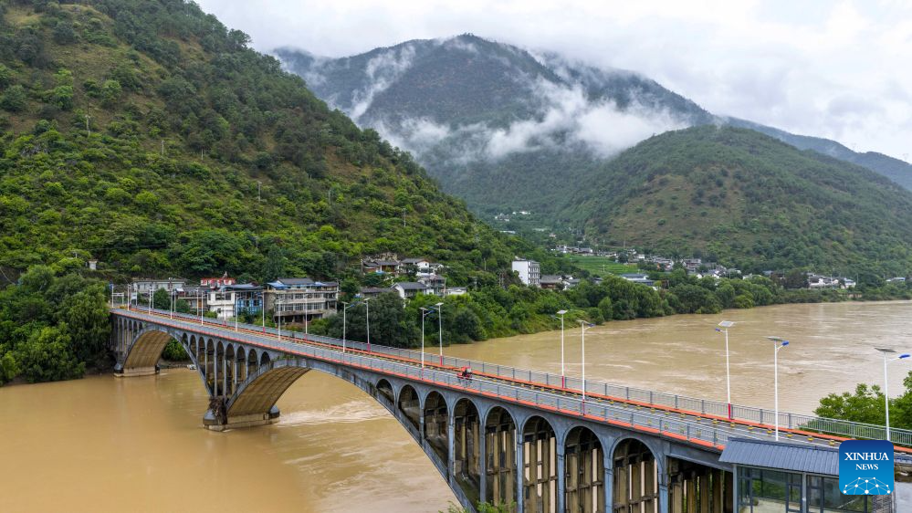
An aerial drone photo taken on July 2, 2026 shows a bridge crossing the Jinsha River along the Yunnan-Xizang Highway, southwest China's Yunnan Province. Fifty years ago on this day, the Yunnan-Xizang Highway, a vital trunk road in China's southwestern border regions, was fully completed and opened to traffic.
Stretching 715 kilometers from Xiaguan County in Yunnan Province to Mangkam County in Xizang Autonomous Region, the route crosses the Jinsha and Lancang rivers, traverses the rugged and geologically complex Hengduan Mountains, and climbs over snow-capped passes. Connecting to the southern section of the Sichuan-Xizang Highway to Lhasa, it has forged a crucial land artery linking Yunnan and Xizang, ending the extreme geographical isolation of China's frontier southwest.
Half a century on, the once primitive lifeline built by manual labor has evolved into a modern alpine highway. More than just a traffic route, the upgraded Yunnan-Xizang Highway weaves together world-famous landscapes and millennia-old ethnic culture, fueling cultural tourism along the route. It has grown into a world-class tourism corridor that powers coordinated regional development and common prosperity for people of various ethnic groups. (Xinhua/Hu Chao)
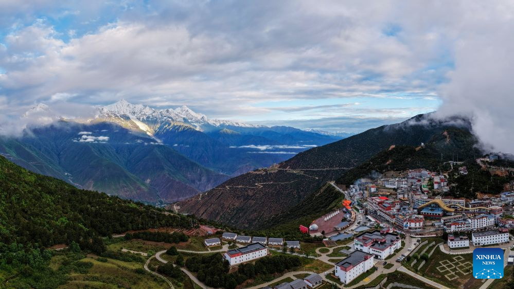
An aerial drone photo taken on July 2, 2026 shows a view along the Yunnan-Xizang Highway, with Meili Snow Mountain in the background, in Deqin County of Deqen Tibetan Autonomous Prefecture, southwest China's Yunnan Province. Fifty years ago on this day, the Yunnan-Xizang Highway, a vital trunk road in China's southwestern border regions, was fully completed and opened to traffic.
Stretching 715 kilometers from Xiaguan County in Yunnan Province to Mangkam County in Xizang Autonomous Region, the route crosses the Jinsha and Lancang rivers, traverses the rugged and geologically complex Hengduan Mountains, and climbs over snow-capped passes. Connecting to the southern section of the Sichuan-Xizang Highway to Lhasa, it has forged a crucial land artery linking Yunnan and Xizang, ending the extreme geographical isolation of China's frontier southwest.
Half a century on, the once primitive lifeline built by manual labor has evolved into a modern alpine highway. More than just a traffic route, the upgraded Yunnan-Xizang Highway weaves together world-famous landscapes and millennia-old ethnic culture, fueling cultural tourism along the route. It has grown into a world-class tourism corridor that powers coordinated regional development and common prosperity for people of various ethnic groups. (Xinhua/Hu Chao)
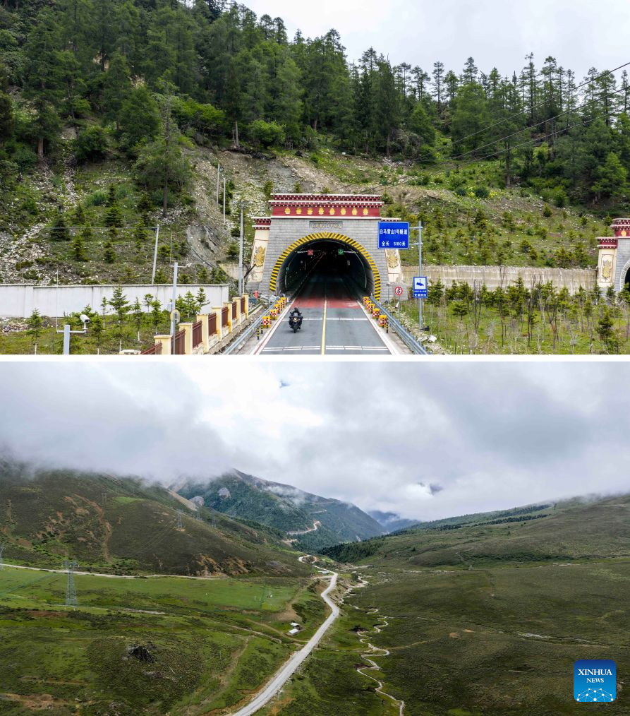
This combo photo shows a tunnel crossing Baima Snow Mountain of the Yunnan-Xizang Highway pictured on Oct. 31, 2016 (above) and a view of the old Yunnan-Xizang road on Baima Snow Mountain pictured on July 1, 2026 (below, aerial drone photo). Fifty years ago on this day, the Yunnan-Xizang Highway, a vital trunk road in China's southwestern border regions, was fully completed and opened to traffic.
Stretching 715 kilometers from Xiaguan County in Yunnan Province to Mangkam County in Xizang Autonomous Region, the route crosses the Jinsha and Lancang rivers, traverses the rugged and geologically complex Hengduan Mountains, and climbs over snow-capped passes. Connecting to the southern section of the Sichuan-Xizang Highway to Lhasa, it has forged a crucial land artery linking Yunnan and Xizang, ending the extreme geographical isolation of China's frontier southwest.
Half a century on, the once primitive lifeline built by manual labor has evolved into a modern alpine highway. More than just a traffic route, the upgraded Yunnan-Xizang Highway weaves together world-famous landscapes and millennia-old ethnic culture, fueling cultural tourism along the route. It has grown into a world-class tourism corridor that powers coordinated regional development and common prosperity for people of various ethnic groups. (Xinhua/Hu Chao)