
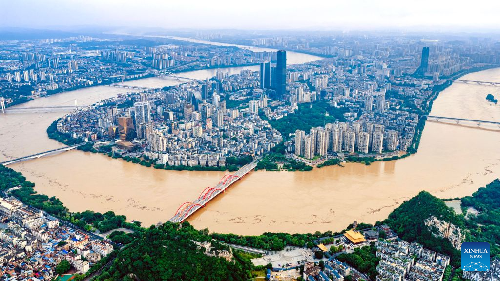
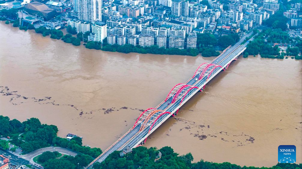
An aerial drone photo taken on June 22, 2026 shows the flood peak passing through the Liujiang River in Liuzhou, south China's Guangxi Zhuang Autonomous Region. Due to heavy rainfall, the Liuzhou hydrological station on the Liujiang River recorded the first flood peak of 2026 on Monday, with the highest water level reaching 85.64 meters, exceeding the alert line by 3.14 meters while flooding some riverfront roads. (Photo by Li Hanchi/Xinhua)
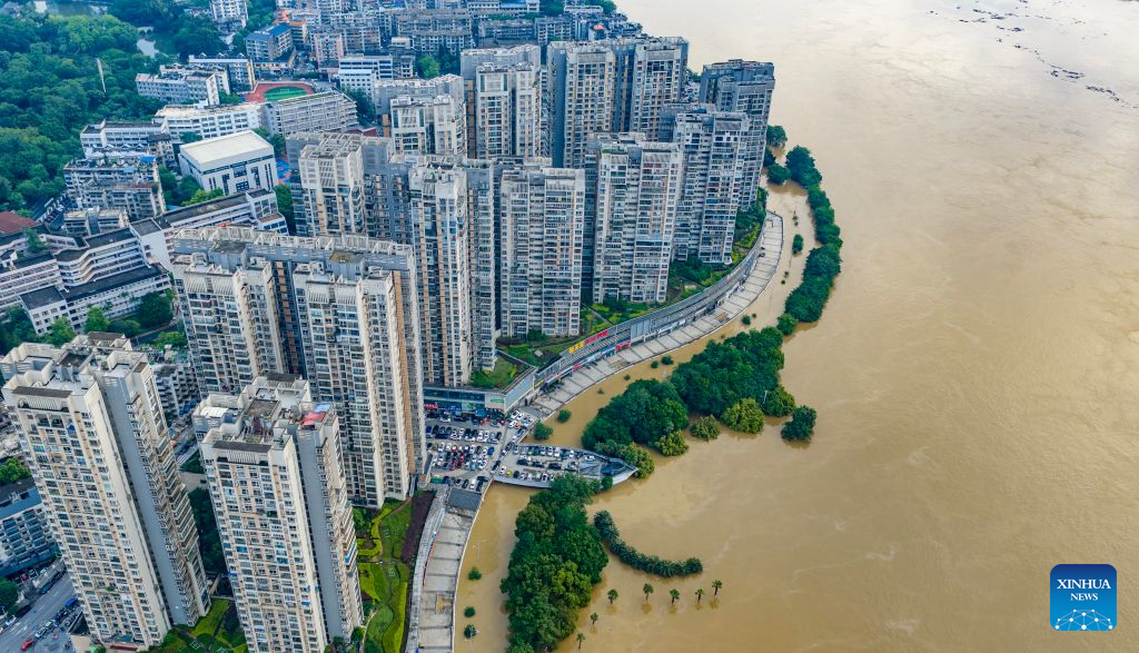
An aerial drone photo taken on June 22, 2026 shows the flood peak passing through the Liujiang River in Liuzhou, south China's Guangxi Zhuang Autonomous Region. Due to heavy rainfall, the Liuzhou hydrological station on the Liujiang River recorded the first flood peak of 2026 on Monday, with the highest water level reaching 85.64 meters, exceeding the alert line by 3.14 meters while flooding some riverfront roads. (Photo by Li Hanchi/Xinhua)
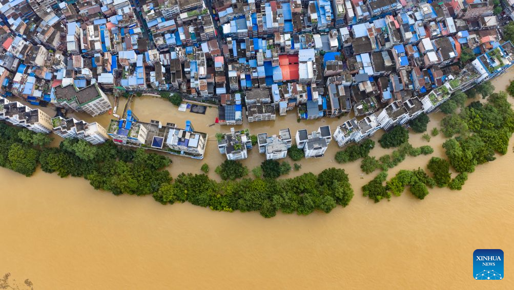
An aerial drone photo taken on June 22, 2026 shows the flood peak passing through the Liujiang River in Liuzhou, south China's Guangxi Zhuang Autonomous Region. Due to heavy rainfall, the Liuzhou hydrological station on the Liujiang River recorded the first flood peak of 2026 on Monday, with the highest water level reaching 85.64 meters, exceeding the alert line by 3.14 meters while flooding some riverfront roads. (Photo by Li Hanchi/Xinhua)
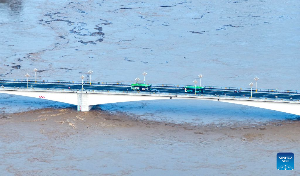
An aerial drone photo taken on June 22, 2026 shows the flood peak passing through the Liujiang River in Liuzhou, south China's Guangxi Zhuang Autonomous Region. Due to heavy rainfall, the Liuzhou hydrological station on the Liujiang River recorded the first flood peak of 2026 on Monday, with the highest water level reaching 85.64 meters, exceeding the alert line by 3.14 meters while flooding some riverfront roads. (Photo by Li Hanchi/Xinhua)
An aerial drone photo taken on June 22, 2026 shows the flood peak passing through the Liujiang River in Liuzhou, south China's Guangxi Zhuang Autonomous Region. Due to heavy rainfall, the Liuzhou hydrological station on the Liujiang River recorded the first flood peak of 2026 on Monday, with the highest water level reaching 85.64 meters, exceeding the alert line by 3.14 meters while flooding some riverfront roads. (Photo by Li Hanchi/Xinhua)


