
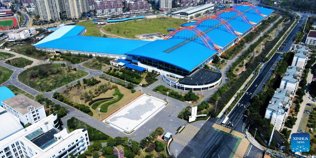
This photo taken on March 17, 2025 shows a bird's-eye view of the Yangtze River flood control model in Wuhan, central China's Hubei Province. (Photo by Lei Lei/Xinhua)
by Yi Ling and Hou Wenkun
WUHAN, May 21 (Xinhua) -- It was not raining and there was no storm. However, inside a cavernous concrete basin in Wuhan, capital of central China's Hubei Province, a 1:400-scale model of the Yangtze River was flooding, with this happening on purpose.
A visit to the Yangtze River flood control model on an early summer morning, weeks after the real flood season began in April, was breathtaking.
Walking into the facility, located in the Wuhan Economic and Technological Development Zone on the shores of a lake, the first thing you notice is its size. It is the world's largest and most advanced physical model of a river system, coverings 65,000 square meters, the equivalent of nine soccer fields.
Soon you realize that what is unfolding before you is a miniature world so detailed that you can recognize river bends, bridges, islands and even the white revetment blocks along the banks. A quick comparison with satellite images confirms the likeness: it is an almost perfect copy of the real thing.
Construction of this facility started in March 2004 and was completed in December 2005. The model was built by the Changjiang River Scientific Research Institute under the Changjiang Water Resources Commission (CWRC), which runs it. In Beijing, meanwhile, the Ministry of Water Resources oversees the national flood control strategy that this model serves.
So why build such a giant replica?
Because the Jingjiang reach and Dongting Lake area, the section replicated here, has always been the Yangtze's most flood-prone stretch. For centuries, floods there have meant disaster for millions. Today, instead of waiting for nature to show its hand, scientists create their own floods.
During each flood season, researchers conduct flood evolution experiments at this facility. At the push of a button, they can simulate a flood on the Yangtze's main stream. They crank up the virtual outflow of the Three Gorges Reservoir to 40,000 cubic meters per second. As the flood crest moves through the model, water levels rise. Green islands and sandbars slowly disappear beneath the surface.
But the most impressive part is what happens underwater -- something no one has ever seen during a real flood.
Scientists use tiny blue plastic particles to track sediment movement. Each particle is about 0.1 mm in diameter, roughly the thickness of a human hair. The team spent two to three years developing them. Under a microscope magnified 100 times, these blue grains look almost identical to real sand and silt.
In a recent test near a place called Guanyinzhou, the model revealed a hidden danger. The left bank was steadily being scoured. White revetment blocks became exposed. Some shifted out of place, a clear sign of potential bank collapse that could threaten the levee. In a real flood, such erosion would remain invisible until it was too late. Here, it is plain to see.
With this knowledge, the CWRC can identify high-risk zones before a flood hits, send early warnings to local communities, and adjust reservoir releases to reduce erosion and levee risks. It is a profound shift from guessing to knowing.
The physical model is only one part of the toolkit. The institute also built a mathematical model covering the entire Yangtze basin. Together with real-time hydrological data, the three pieces form an integrated platform that turns flood control from reactive emergency response into proactive risk identification.
The model does a lot more than fighting floods. It can also simulate precision water releases to combat droughts hundreds of kilometers downstream.
It further serves as a test site for bridge piers and navigation channels. Engineers use it to figure out how many piers a new bridge should have, where to place them, and how to improve shipping routes.
Thanks to validation from this model, the second phase of the Yangtze navigation channel improvement project was completed this year. Now, 5,000-tonne vessels can reach Chongqing, a major port city in the upper Yangtze in southwest China, year-round, which is a major boost for the middle Yangtze's shipping capacity.
As the 2026 flood season approaches, the CWRC is using this Wuhan model daily to fine-tune forecasts and schedules. Standing in that huge hall, watching a tiny blue particle drift with the current, a visitor might think: somewhere downstream, a community would be safer because of what that little grain of plastic just revealed.
No one can tame a river as mighty as the Yangtze. But this model helps China understand its "temper," and live with it more wisely. ■
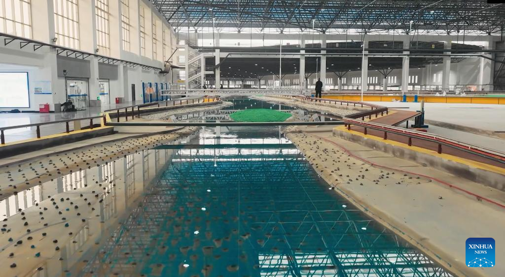
This photo taken on Jan. 5, 2026 shows a partial view of the Yangtze River flood control model in Wuhan, central China's Hubei Province. (Photo by Lei Lei/Xinhua)
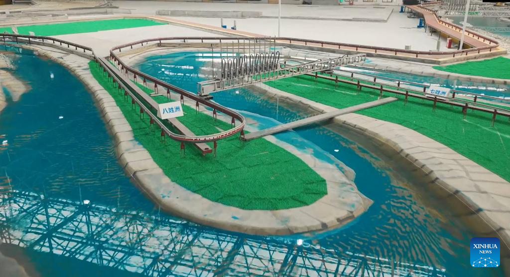
This photo taken on Jan. 5, 2026 shows a partial view of the Yangtze River flood control model in Wuhan, central China's Hubei Province. (Photo by Lei Lei/Xinhua)
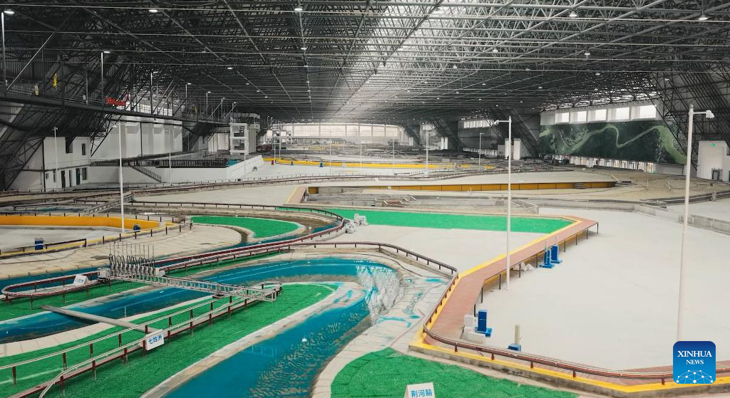
This photo taken on Jan. 5, 2026 shows an interior view of the Yangtze River flood control model in Wuhan, central China's Hubei Province. (Photo by Lei Lei/Xinhua)


