BEIJING, Feb. 9 (Xinhua) -- Powerful earthquakes struck southeastern Türkiye and northern Syria on Monday. Thousands of people are confirmed dead across Türkiye and Syria, with numbers expected to rise. The earthquakes destroyed people's homes and local infrastructure. Satellite images taken by China's Jilin-1 satellites show the scale of the devastation wrought by the huge earthquake in vivid detail. Take a look.
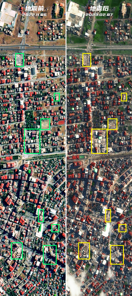
Türkiye's southern province of Kahramanmaras was hard hit. Satellite images taken by China's Jilin-1 satellites showed buildings almost flattened to the ground in the province's Turkoglu district, leaving a trail of rubble that underscored the difficulty of rescue efforts. (Photo credit: China's Jilin-1 satellites)
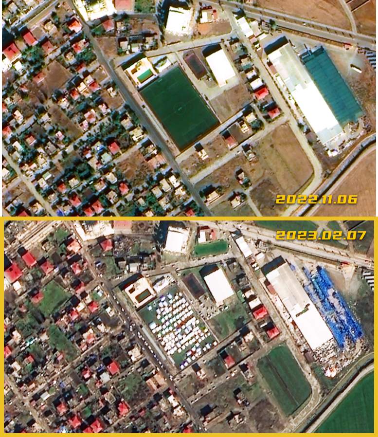 After the earthquake, many people were left homeless. A soccer stadium in Turkoglu is packed with white tents that serve as makeshift shelters. (Photo credit: China's Jilin-1 satellites)
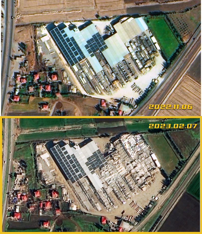
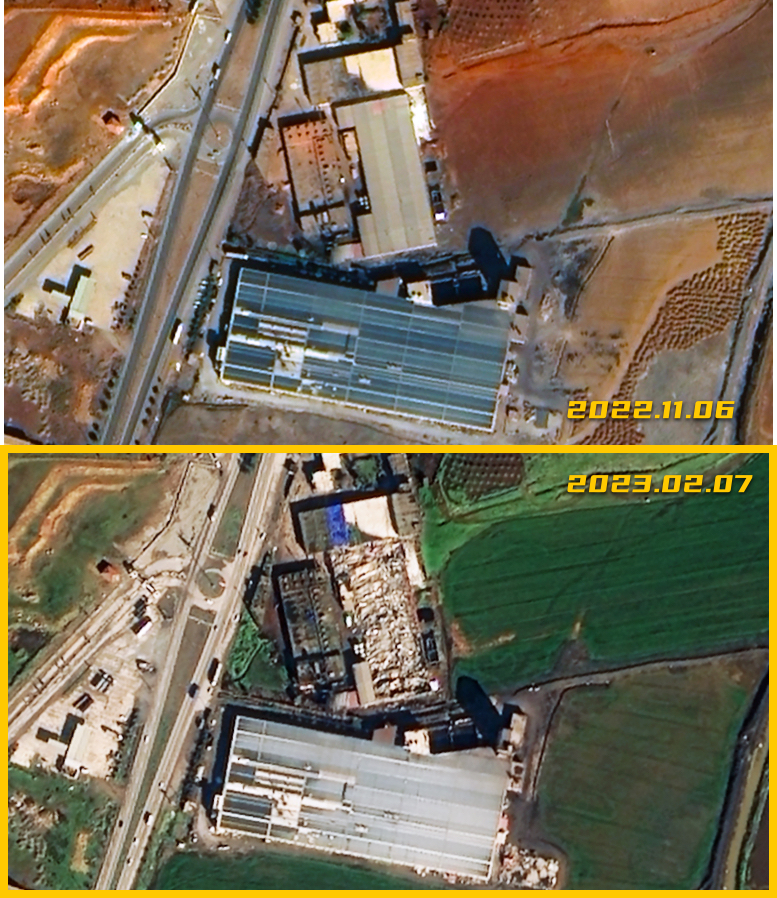
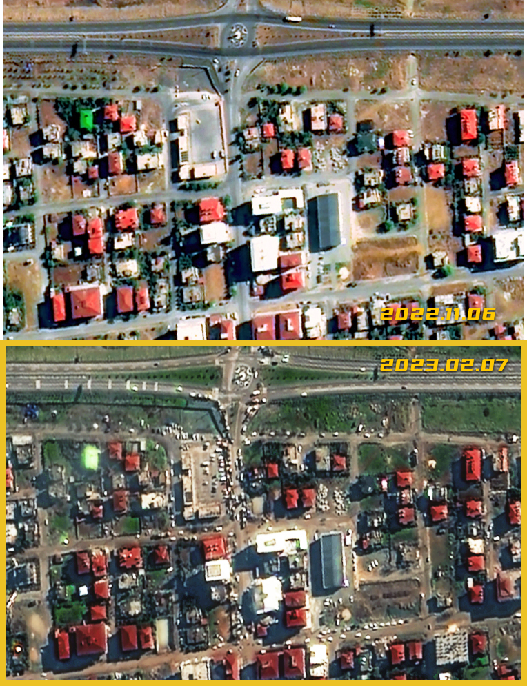
The Islahiye area of Gaziantep Province in southeastern Türkiye was also badly hit. Satellite images showed several buildings collapsed across the city, including a high-rise building that had collapsed on the side of a road. The site was covered with white rubble and debris. (Photo credit: China's Jilin-1 satellites)
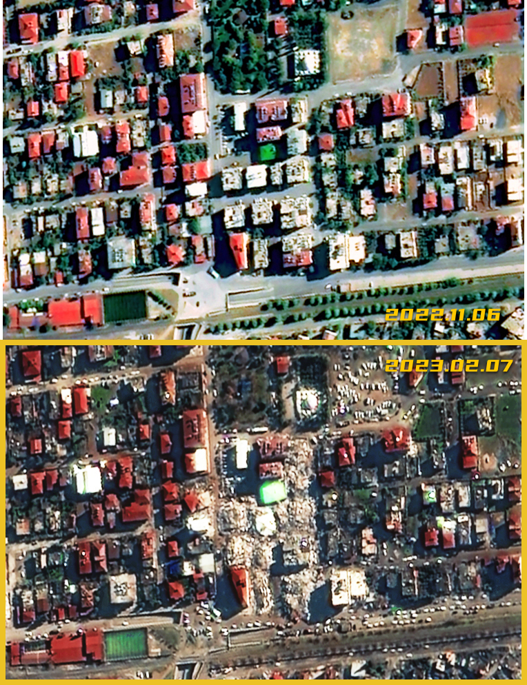
A cluster of residential buildings in downtown Islahiye was almost flattened. (Photo credit: China's Jilin-1 satellites)
Satellite images taken after the quake showed an open area near the highway crowded with vehicles. (Photo credit: China's Jilin-1 satellites)