
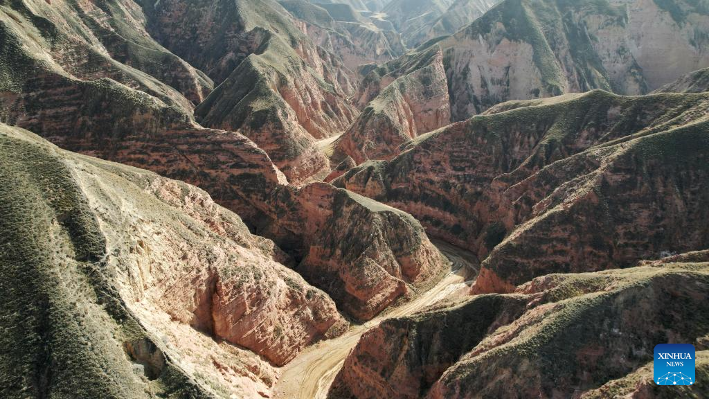
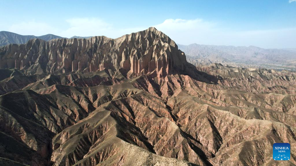
This aerial drone photo taken on April 4, 2026 shows a view of the Shilaquan Canyon in Tangwang Town of Dongxiang Autonomous County, Linxia Hui Autonomous Prefecture, northwest China's Gansu Province. Shilaquan Canyon has an average elevation of approximately 2,000 meters. The red sandstone and gravel layers on both sides of the canyon have been shaped by water erosion and wind abrasion, forming a distinctive Danxia landform. (Xinhua/Chen Bin)
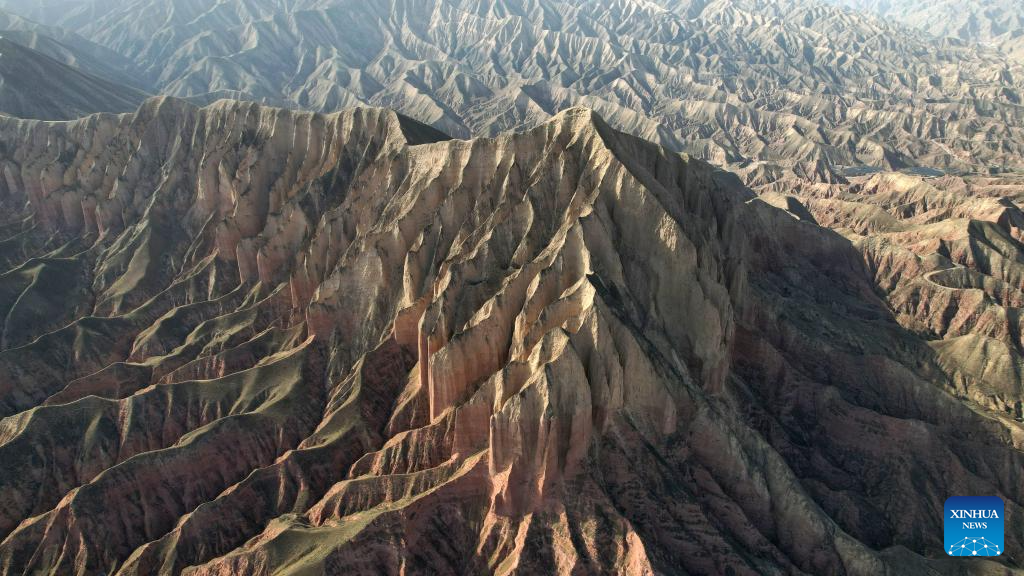
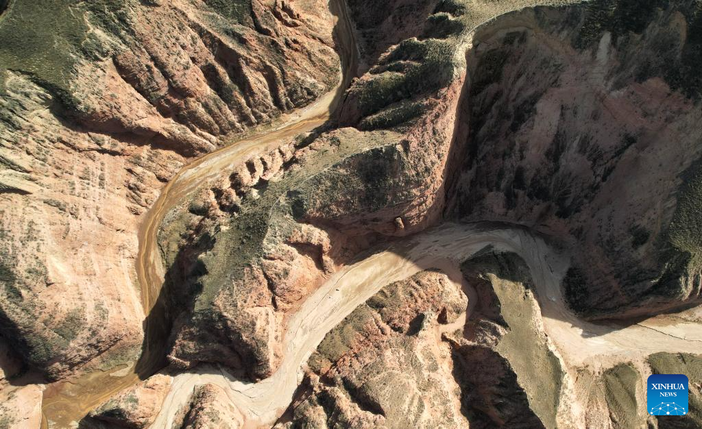
This aerial drone photo taken on April 4, 2026 shows a view of Danxia landform in the Shilaquan Canyon in Tangwang Town of Dongxiang Autonomous County, Linxia Hui Autonomous Prefecture, northwest China's Gansu Province. Shilaquan Canyon has an average elevation of approximately 2,000 meters. The red sandstone and gravel layers on both sides of the canyon have been shaped by water erosion and wind abrasion, forming a distinctive Danxia landform. (Xinhua/Chen Bin)
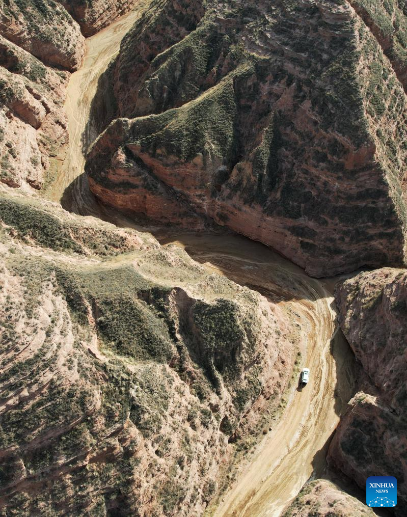
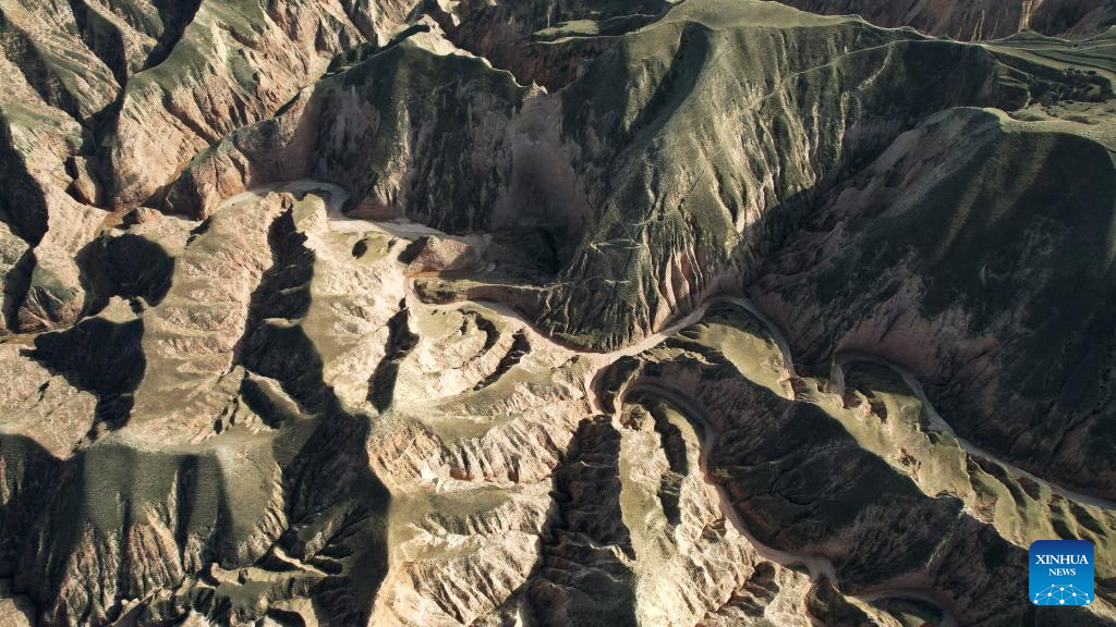
This aerial drone photo taken on April 4, 2026 shows a view of the Shilaquan Canyon in Tangwang Town of Dongxiang Autonomous County, Linxia Hui Autonomous Prefecture, northwest China's Gansu Province. Shilaquan Canyon has an average elevation of approximately 2,000 meters. The red sandstone and gravel layers on both sides of the canyon have been shaped by water erosion and wind abrasion, forming a distinctive Danxia landform. (Xinhua/Chen Bin)
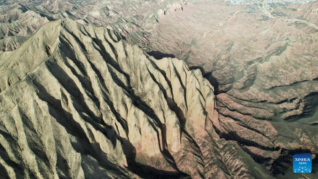
This aerial drone photo taken on April 4, 2026 shows a view of Danxia landform in the Shilaquan Canyon in Tangwang Town of Dongxiang Autonomous County, Linxia Hui Autonomous Prefecture, northwest China's Gansu Province. Shilaquan Canyon has an average elevation of approximately 2,000 meters. The red sandstone and gravel layers on both sides of the canyon have been shaped by water erosion and wind abrasion, forming a distinctive Danxia landform. (Xinhua/Chen Bin)
This aerial drone photo taken on April 4, 2026 shows a view of Danxia landform in the Shilaquan Canyon in Tangwang Town of Dongxiang Autonomous County, Linxia Hui Autonomous Prefecture, northwest China's Gansu Province. Shilaquan Canyon has an average elevation of approximately 2,000 meters. The red sandstone and gravel layers on both sides of the canyon have been shaped by water erosion and wind abrasion, forming a distinctive Danxia landform. (Xinhua/Chen Bin)
This aerial drone photo taken on April 4, 2026 shows a view of the Shilaquan Canyon in Tangwang Town of Dongxiang Autonomous County, Linxia Hui Autonomous Prefecture, northwest China's Gansu Province. Shilaquan Canyon has an average elevation of approximately 2,000 meters. The red sandstone and gravel layers on both sides of the canyon have been shaped by water erosion and wind abrasion, forming a distinctive Danxia landform. (Xinhua/Chen Bin)
This aerial drone photo taken on April 4, 2026 shows a view of the Shilaquan Canyon in Tangwang Town of Dongxiang Autonomous County, Linxia Hui Autonomous Prefecture, northwest China's Gansu Province. Shilaquan Canyon has an average elevation of approximately 2,000 meters. The red sandstone and gravel layers on both sides of the canyon have been shaped by water erosion and wind abrasion, forming a distinctive Danxia landform. (Xinhua/Chen Bin)

This aerial drone photo taken on April 4, 2026 shows a view of the Shilaquan Canyon in Tangwang Town of Dongxiang Autonomous County, Linxia Hui Autonomous Prefecture, northwest China's Gansu Province. Shilaquan Canyon has an average elevation of approximately 2,000 meters. The red sandstone and gravel layers on both sides of the canyon have been shaped by water erosion and wind abrasion, forming a distinctive Danxia landform. (Xinhua/Chen Bin)


